
Iran’s Natural Fortress: A Complete Account of the Geographic Logic Behind a Land Power
Iran’s terrain — a 1,600-kilometer strategic depth, three concentric mountain walls, and vast deserts on every open flank — makes it one of the hardest countries on earth to invade and occupy, according to classical geopolitical theory. This piece breaks down, region by region, why ground invasion is nearly unthinkable, and why the only realistic existential threat lies not on the battlefield but in internal social and political cohesion.
Introduction: Why Geography Matters More Than Headlines
Every time the possibility of a military attack or occupation of Iran surfaces in media debates, most analysis revolves around military budgets, hardware, or political will — while a more fundamental variable, one that no sanction, diplomatic maneuver, or advanced weapons system can change, is routinely ignored: terrain. In the classical tradition of geopolitics, from Halford Mackinder‘s 1904 “Heartland” theory to Nicholas Spykman‘s 1940s “Rimland” concept, a shared premise runs through the field: the geographic structure of a territory shapes its strategic limits and possibilities for centuries, regardless of which regime governs it.
This piece sets out to show why, within this analytical framework, Iran cannot be compared to countries such as Iraq, Syria, or Libya — states that have experienced structural collapse or military occupation in recent decades. The difference is not momentary military strength but the architecture of the land itself: a combination of strategic depth, mountain walls, vast deserts, and narrow coastlines that together form what military analysts call terrain that “cannot be channeled at a reasonable cost.”
Part One: Iran Within Classical Geopolitical Theory
The Concept of “Intrinsic Land Power”
In the standard classification of global powers, two broad categories exist: sea powers, whose strategic existence rests on controlling maritime routes and global trade — Britain in the nineteenth century, or the United States today — and land powers, whose strength is built on territorial extent, depth, and domestic self-sufficiency, such as Russia or China. Iran occupies a distinctive position in this classification: it simultaneously has access to the open waters of the south (the Persian Gulf and the Sea of Oman) and to the continental resources of the north (the Caspian Sea and Central Asia), yet its defensive and economic structure rests largely on land-power logic. This combination — sometimes referred to by analysts as Intrinsic Land Power — means that Iran, unlike actors such as the UAE or Qatar whose existence depends almost entirely on external control of maritime routes and foreign military backing, has a self-sufficient domestic base that few countries in the region possess.
Comparison With the “Small Continent” Pattern
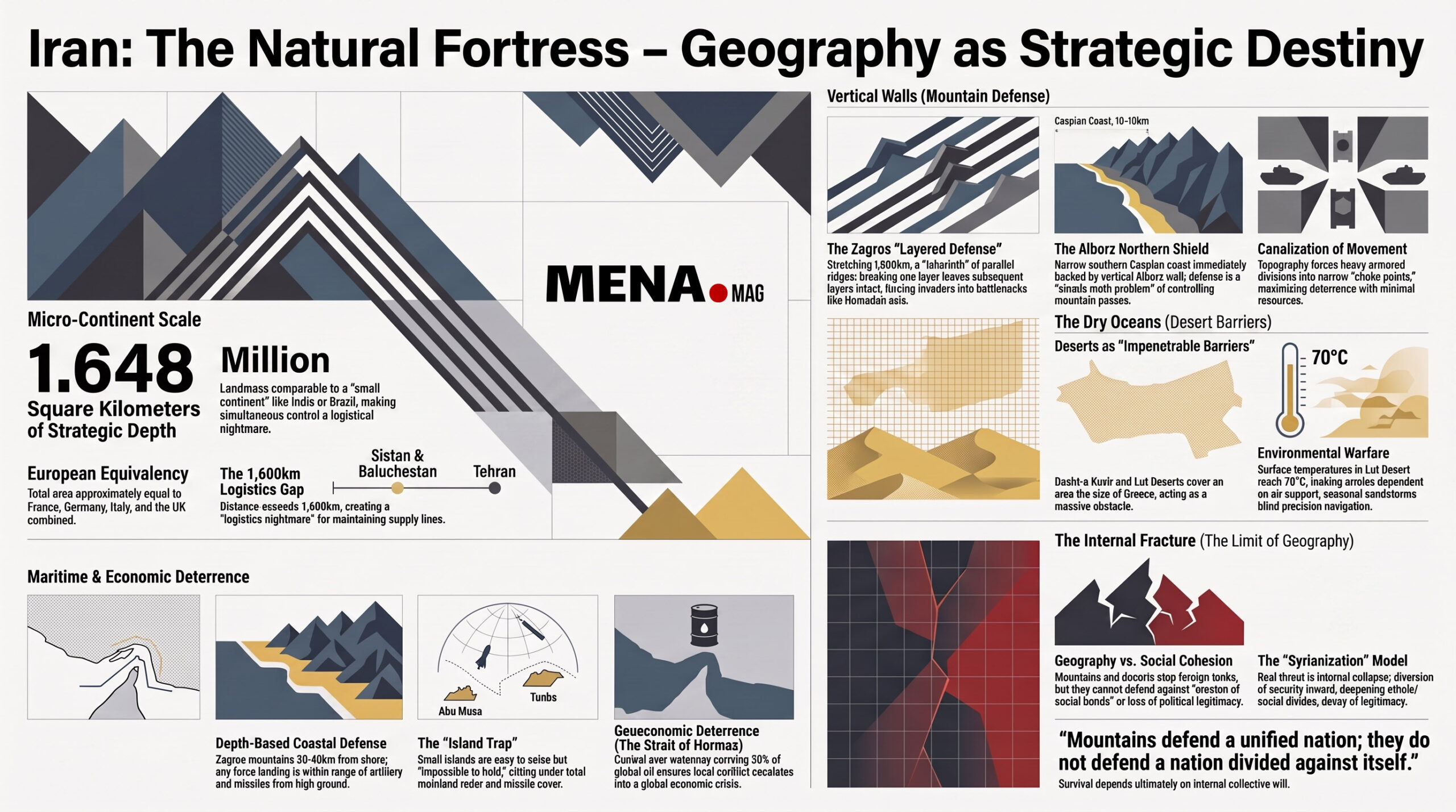
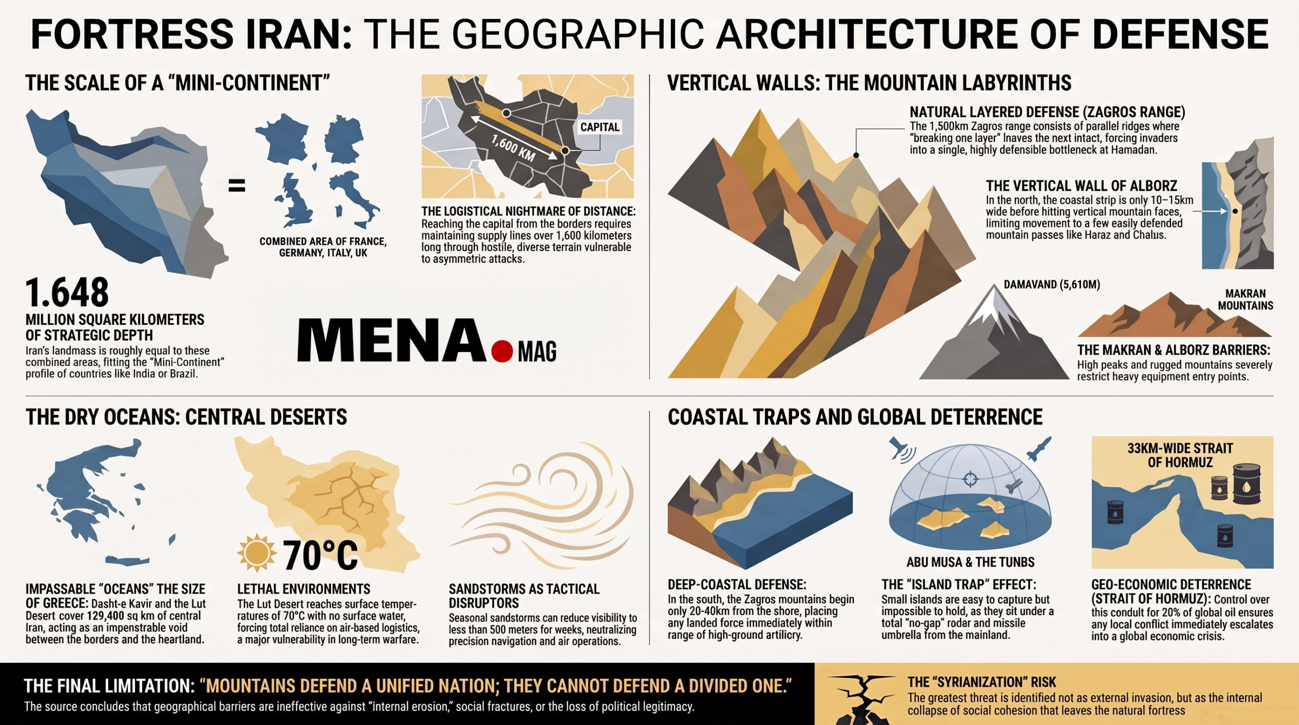
In geopolitical literature, the term “small continent” is applied to countries whose size, climatic and demographic diversity, and internal complexity set them apart from ordinary nation-states — Brazil, India, and to some extent Russia are the classic examples. With an area of roughly 1.648 million square kilometers (comparable to the combined area of France, Germany, Italy, and Britain), and a climate range spanning cold mountainous zones to semi-tropical coastlines and arid deserts, Iran’s structure fits this pattern far more closely than it fits countries like Jordan or Lebanon, whose entire territory is smaller than a single large Iranian province.
The practical consequence of this structural difference shows up in the military domain: occupying a small, homogeneous country — Kuwait in 1990 — can be achieved with a limited operation, but simultaneously controlling territory of this size and diversity requires a dispersal of military force at a scale no invading army in the modern history of the region has ever been able to sustain.
Part Two: A Detailed Account of Natural Barriers by Direction
North: The Alborz Wall and the Caspian Coastal Bottleneck
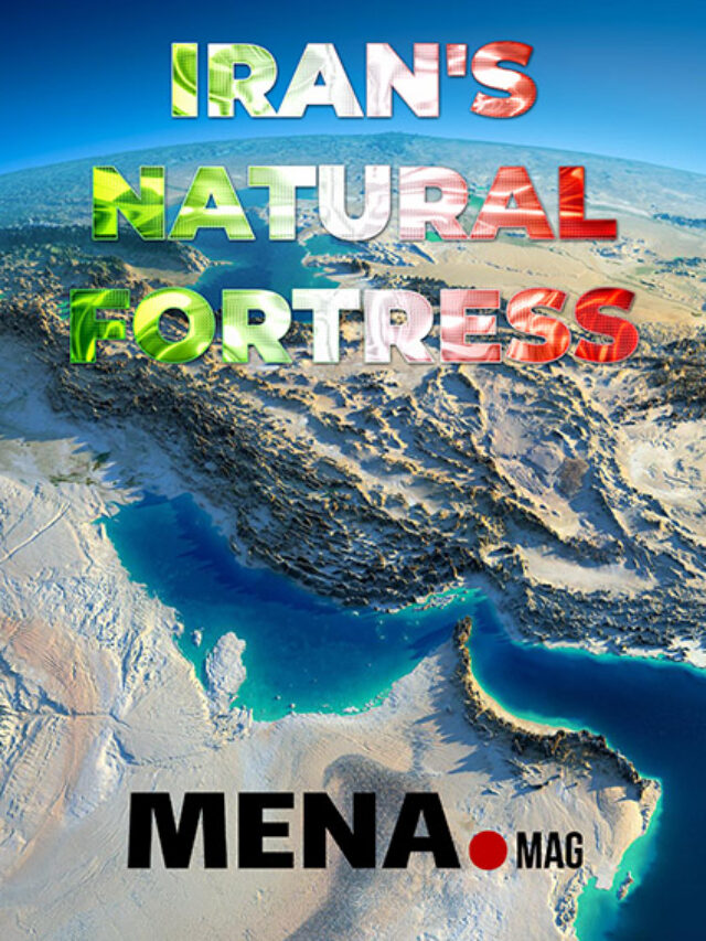
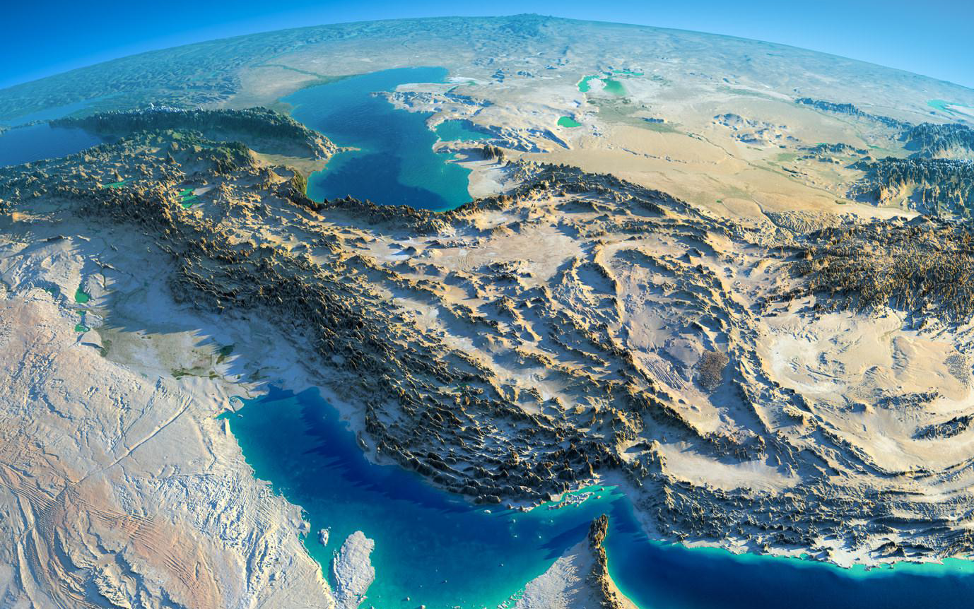
The Caspian Sea, covering roughly 371,000 square kilometers, is the largest enclosed body of water on Earth. But what makes this front distinctive from a defensive standpoint is not the sea itself, but the extraordinary narrowness of its southern coastal strip: at its widest point, from Chehreh to Babolsar, the distance between the coastline and the mountain base is only 41 kilometers — and in many other stretches, it narrows to under 10–15 kilometers. This means any hypothetical force landing from the Caspian would immediately face the vertical wall of the Alborz range — home to Mount Damavand (5,610 meters, the highest peak in the Middle East) — a range that limits the number of passages usable by heavy equipment to a handful of routes (such as the Haraz and Chalus roads). Such topography turns defense into a simple mathematical problem: the defender only needs to control a few passages, not hundreds of kilometers of open frontage.
East: The Sand Ocean of the Lut and Dasht-e Kavir Deserts
The Dasht-e Kavir and the Lut Desert together cover roughly 129,400 square kilometers — an area close to the size of Greece. The Lut Desert, identified by NASA in recent years as one of the hottest spots on Earth’s surface (with recorded surface temperatures above 70°C), lacks any reliable surface water source across long stretches. For a modern military force, this means total dependence on airborne logistical support for water and fuel — a dependency that has repeatedly proven to be the central weakness of large-scale operations throughout modern military history, from Germany’s defeat at Stalingrad to coalition logistics challenges in the Iraqi desert.
West and Northwest: The Labyrinth of the Zagros
The Zagros range, stretching nearly 1,500 kilometers from the northwest to the southeast of the country, is not a single mountain chain but a network of parallel, interlocking ranges separated by narrow, hard-to-cross valleys. Peaks such as Alvand (3,574 meters), Dalahu (3,359 meters), and Kabir Kuh, together with hundreds of smaller passes, form what military analysts call “natural layered defense”: even if one layer of mountains is breached, the next remains intact. In the northwest, the highlands of West Azerbaijan province — with an average elevation of 1,700–1,800 meters, and the peak of Khoy Dagh (Little Sahand or Qalajuq) rising above 3,000 meters — extend this pattern to the borders of Turkey and Armenia. The only genuine chokepoint for large-scale armored movement from the west toward the country’s center is the Hamedan corridor — and this forced concentration allows the defender to generate maximum deterrence with minimal resources.
South and Southwest: The Coastal Strip and the Hoor al-Azim Trap
The southern coastline follows a pattern similar to the north: the Zagros extends nearly to the Persian Gulf and Sea of Oman shoreline, leaving only a narrow strip of coastal plain. In the southwest, the Hoor al-Azim wetlands (expanding to over 1,000 square kilometers during wet seasons) and the extensive network of tributaries from the Karun River turn the Khuzestan plain into a natural obstacle — one that also played a documented strategic role in slowing armored advances during the Iran-Iraq War (1980–1988).
Part Three: A Detailed Analysis of Four Hypothetical Ground Fronts
Sistan and Baluchestan: The Forgotten but Impenetrable Front
This province, covering roughly 181,000 square kilometers (larger than Greece), has the lowest density of road and rail infrastructure in the country. The Makran mountain range — stretching along the Sea of Oman coast to the Pakistani border — and Mount Taftan (a semi-active volcano at 4,042 meters) confine passage to a handful of routes. The distance from this region to Tehran exceeds 1,600 kilometers — meaning any hypothetical invading force would need to protect supply lines of that same length against potential guerrilla operations before reaching any real strategic target. The province’s distinct tribal and ethnic makeup also means that without cooperation, or at minimum the passivity, of the local population, no sustained foreign presence is realistically possible — a pattern repeated by foreign forces in comparable regions from Afghanistan to Yemen.
Hormozgan and Bushehr: The Hormuz Chokepoint and the Zagros Wall
The coastal strip of these two provinces is, in many places, less than 30–40 kilometers wide before reaching the Zagros highlands. This narrowness means any force landing from the sea would immediately come within range of artillery and missile systems positioned on the commanding heights — a configuration military literature calls “depth-based coastal defense.” The Strait of Hormuz, meanwhile, narrows to 33 kilometers at its tightest point, with only two navigable shipping lanes (each three kilometers wide), carrying roughly 20 percent of the world’s oil consumption. This combination — geographic control over a global energy chokepoint — means any military tension in the area immediately takes on dimensions far beyond a bilateral conflict, drawing in the global economy; a deterrent many analysts describe as “geographic-economic deterrence.”
East: The Desert as a Dry Ocean
Iran’s eastern border with Afghanistan and Pakistan is backed by the Lut Desert — an obstacle that must be crossed before reaching any real population or industrial center. The scattered mountain ranges of Khorasan (Binalud, with a peak at 3,211 meters, Aladagh, and Hezar Masjed) further restrict passage routes. Seasonal sandstorms in this region, capable of reducing visibility to under 500 meters, can disrupt air operations and precision navigation for weeks. Logistically, the absence of standard road infrastructure deep in the desert means an armored column could take days to cover a distance that would take hours on a paved highway — a delay that eliminates any element of surprise.
The Persian Gulf Islands: A Trap Made Dangerous by Proximity
The islands of Abu Musa, Greater and Lesser Tunb, Qeshm, and Hormuz are, for the most part, very small in area (Abu Musa around 12 square kilometers, Greater Tunb around 10.5 square kilometers). Contrary to first impressions, this small size is not a weakness but a defensive trap: the islands’ proximity to the mainland means missile and radar systems positioned along the coast and interior highlands provide complete, blind-spot-free coverage, while their limited area denies any invading force room to disperse or take cover. The result is what military analysts describe as an “island trap”: an island that appears easy to seize is, because of its closeness to an armed and ready coastline, far harder to hold.
Part Four: Why This Combination Breaks the Regional Military Pattern
A review of the past three decades of Middle Eastern military history — the 2003 invasion of Iraq, the 2011 intervention in Libya, or the Syrian civil war since 2011 — reveals a common pattern: in each case, the target’s geography was largely open plains or accessible coastline, enabling rapid armored maneuver and close air support. Iran departs entirely from this pattern. To grasp the difference, consider one question: coalition forces reached Baghdad in under a month during the 2003 invasion of Iraq — what distance must be covered from Iran’s western border to Tehran, and what does that route pass through? The answer is exactly what this piece has laid out: hundreds of kilometers of mountains, narrow chokepoints, and supply lines where every kilometer is a potential target for ambush and asymmetric attack.
This structural difference explains why, in serious strategic discourse — as opposed to media commentary — the military option against Iran is almost always confined to targeted air and missile strikes, not a regime-change scenario built on ground occupation. This limitation stems not from a lack of political will, but from the simple cost-benefit calculation any serious military command must make before any decision.
Part Five: The Only Alternative Scenario — Erosion From Within, Not Invasion From Without
But this very deadlock raises another question, one that has taken on growing importance in contemporary geopolitical analysis: if the direct military path is closed, where does the real strategic threat to Iran’s territorial cohesion come from? The common answer in this literature points not to the battlefield, but to internal social and political structure.
Syria’s experience is frequently cited in this framework as a model: before 2011, the Syrian army was, on a regional scale, a substantial force in terms of equipment and manpower. Yet without any direct foreign military superiority, the collapse of internal cohesion — deepened ethnic and sectarian divides, rising social distrust, and the gradual erosion of the government’s legitimacy from within — was enough to bring down a structure that might otherwise have withstood a classical military invasion. This pattern shows that natural defensive barriers, however effective against foreign armies, mean nothing against collapse from within — because mountains and deserts cannot defend social cohesion.
On this basis, this analytical framework holds that three factors must converge simultaneously to neutralize Iran’s natural barrier — not one factor alone:
- First, the diversion of security forces’ focus away from borders and defensive readiness toward managing internal crises — a shift that pulls resources and strategic attention away from where they are effective (border defense) toward where they are less so.
- Second, the deepening of social and ethnic divides, to the point where the shared defense of the homeland, instead of being a unifying value, becomes a contested issue — since popular mobilization, cited earlier in this piece as one of the pillars of Iran’s resilience, means little without social cohesion.
- Third, the gradual erosion of government legitimacy, to the point where resistance to foreign intervention shifts from being a national consensus to a divisive political question.
None of these three factors alone can neutralize Iran’s natural barriers; but their combination — sometimes referred to informally in analytical literature as “Syrianization” — can hollow out the country’s natural fortress not from the outside, but from within: not by breaking the Zagros mountains, but by breaking the collective will that stands behind them.
Conclusion: Geography Is a Necessary Condition, Not a Sufficient One
The conclusion of this piece can be summarized in a single sentence: geography has made Iran one of the most difficult targets on Earth for classical military invasion — a 1,600-kilometer strategic depth, the triple ring of the Zagros-Alborz-Makran mountains, an area of 1.6 million square kilometers, climatic and resource diversity, an 85-million-strong native population, and control over a global energy chokepoint together push the cost of any ground occupation to a level no actor, in any plausible scenario, could justify. Yet this same geography is neutral in the face of erosion of internal social and political cohesion. Mountains defend a unified nation; they do not defend a nation standing against itself. Understanding this may be the most important lesson a serious geopolitical analysis of Iran can offer — not blanket reassurance, and not exaggerated alarm, but a precise understanding of where the real threat actually lies.
This piece is based on the geographic and topographic data provided and was written within the classical geopolitical analytical tradition (theories of strategic depth, layered defense, and land power). The figures and elevations cited are approximate and drawn from general geographic sources. The purpose of this piece is to offer a conceptual framework for understanding Iran’s strategic position, not to predict future military or political events with certainty.